

This past month I set out to drive1 the boundary of the Between the Lakes Treaty [1792] which covers present-day Hamilton. I wanted to try and engage with the treaty in both a physical and contemporary sense, to experience the treaty as an ongoing agreement that relates to actual land.
The first problem was determining the exact boundaries of the tract. Some portions of the border are quite easy to identify — the shorelines of Lake Ontario and Lake Erie, or the path of Deshkan Ziibi/ the Thames River. Others simply consist of a bearing and a distance, “from thence north forty-five degrees, west fifty-miles.” As treaty-making progressed in Ontario, the treaty boundaries became more relative, such as, “thence down Lake Erie to the lands heretofore purchased from the said nation of Messissague Indians,” stepping back further from physical markers and requiring an understanding of how the various treaties intersect.
Comparing the boundaries of the Between the Lakes tract in York University’s Mapping Land Theft App with the Ontario Government’s Maps of Treaties and Reserves, there are some places where they document the same boundaries and others where they diverge. Even native-land.ca, an excellent resource for viewing how traditional territories overlap, opens with the caveat, “This map does not represent or intend to represent official or legal boundaries of any Indigenous nations. To learn about definitive boundaries, contact the nations in question.”
So, I took their advice and got in touch with Darin P. Wybenga, the Traditional Knowledge and Land Use Coordinator for the Mississaugas of the Credit First Nation. He told me, “There are no specific landmarks to be noted of which we are aware,” but was kind enough to share a more detailed map, which appears below, annotated (by me) with each of the eight corners I’ll cover.

My next step was to translate the boundary into a drivable route, which involved a lot of time in Google Maps fighting against the fastest route calculator. Long sections of the treaty boundary do not have corresponding roads, and some that do, do not run in the same direction as the boundary.
I’ll add the same caveat as the other maps — my hope in engaging with the specific boundaries of the treaty is not to reinforce rigid colonial ideas of borders, but to begin to understand the treaties in a specific sense. This is my attempt, a provisional gesture toward a more granular, grounded understanding, but it is still largely guesswork.
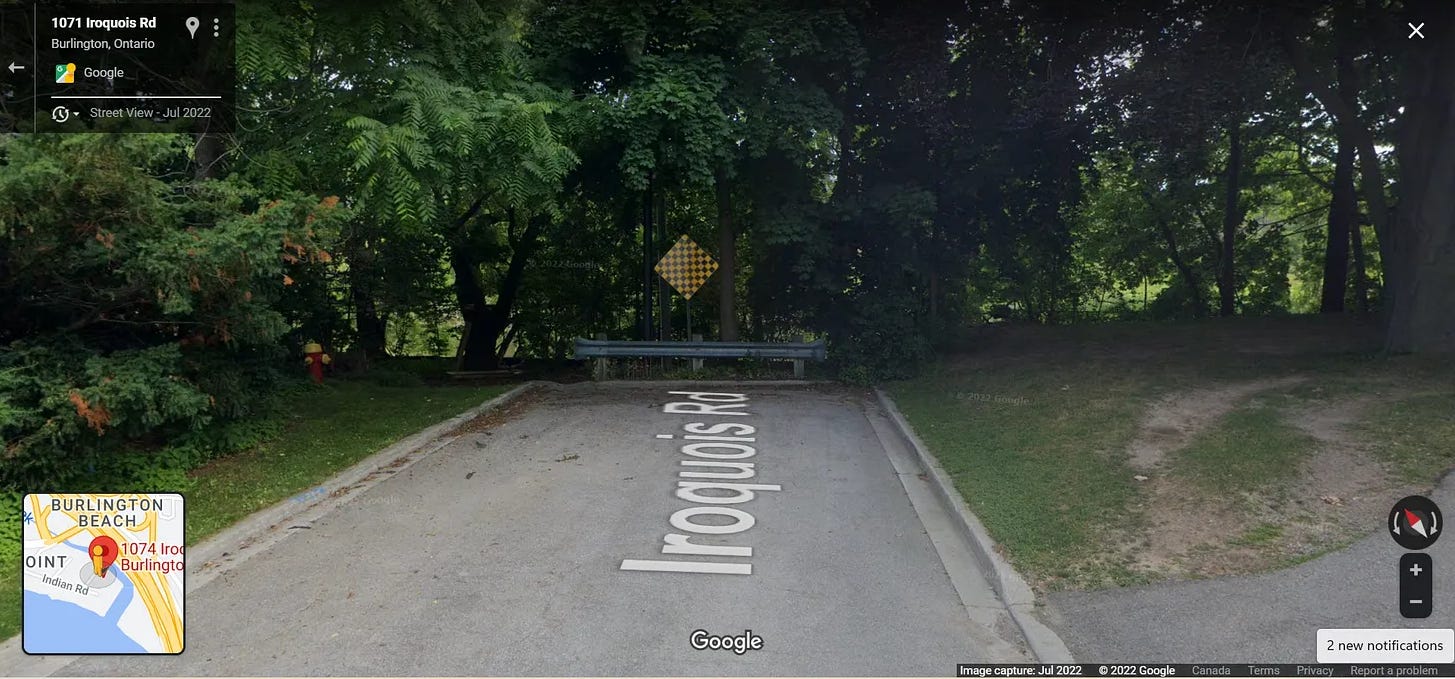
I split the drive up over three separate trips, starting with the corner closest to me which is “the creek that falls from a small lake known by the name of Washquarter into the said Lake Ontario.” Based on the MCFN map, the creek mentioned is present-day “Indian Creek” which runs through the Indian Point neighbourhood in Burlington.2
The neighbourhood is set apart from the North Service Road by a large stone fence and consists of thirty homes, on three streets across fifteen acres. There are no sidewalks, and the only parking is on the long, looping driveways. It’s difficult to get close to the creek itself, pinned as it is between an eight-foot high chain link fence just beyond the black and yellow checkerboard (above) and the 210-foot-high Burlington Bay James N. Allan Skyway on the other side. Despite all of the traffic noise and concrete, I did spot two ducks swimming just beyond the fence.

As Darren Wybenga told me, “A portion of the northeastern boundary of this particular treaty has acquired limited fame and is known as the Jones Baseline,” the same Jones I have been harping on about in the newsletter. I’ll go into more detail about this section of the trip in a future instalment, but essentially, the direction is “north forty-five degrees, west fifty-miles;” which runs parallel to Highway 6, through Waterdown, Carlisle, Guelph and Fergus to this skidmarked turn around just outside of Arthur, Ontario.
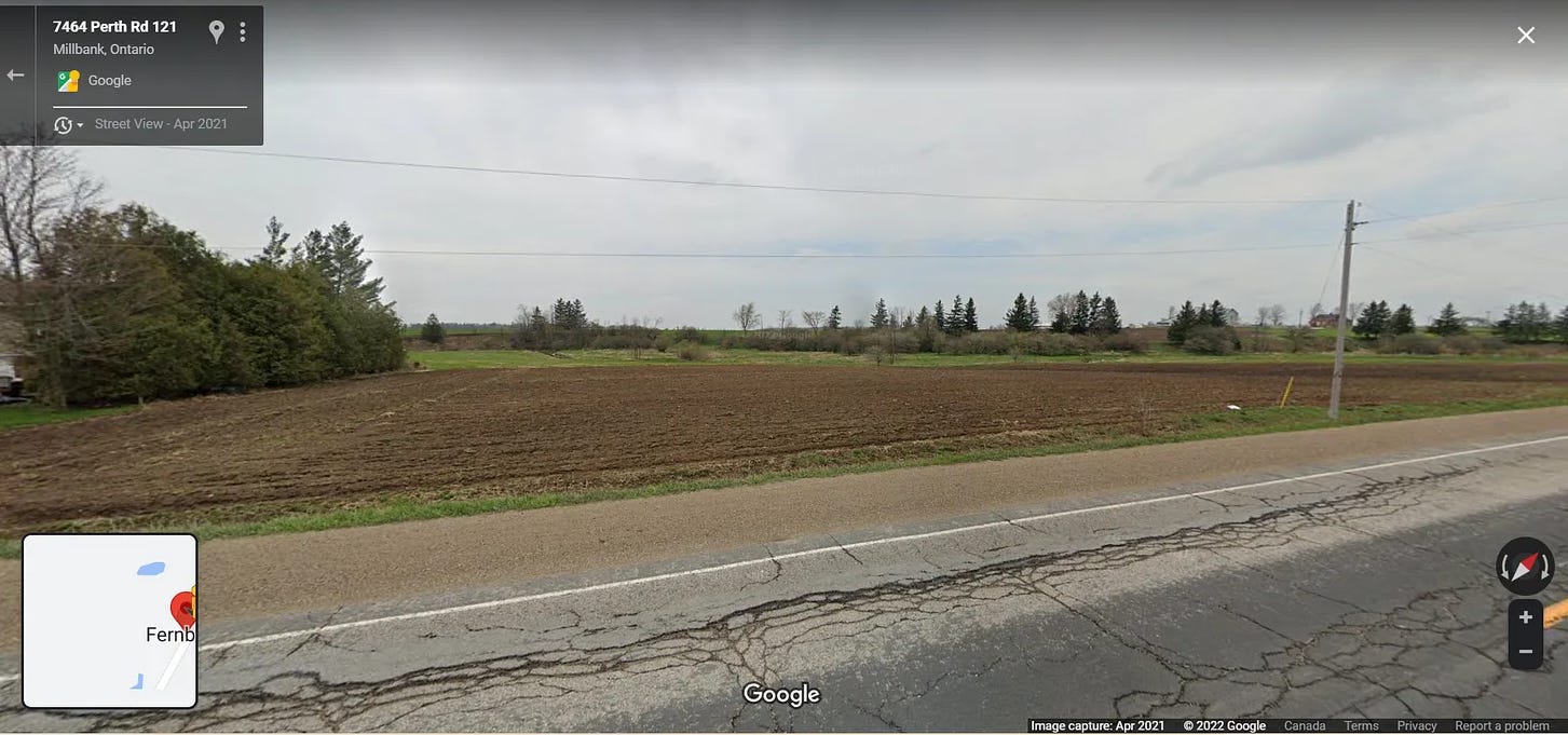
From here, “south forty-five degrees, west twenty-miles.” This is one of the sections where the roads run southwest, but not quite at forty-five degrees, so I needed to shift over a concession every so often. The corner is much harder to find here, likely in the middle of a cornfield like the one above.
Because turns 2 & 3 were Jones & company’s attempt to correct their course when they realized their initial baseline wouldn’t meet Deshkan Ziibi/the Thames, this portion is effectively the shape of someone getting lost. Out here, some of the sideroads still don’t have Streetview available, which seems like the contemporary equivalent of being unsurveyed.
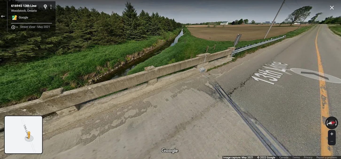
From here, “south until it strikes the River La Tranche.” Again, the roads don’t run exactly south but this was as close as I could get, somewhere outside of Tavistock. Beyond here, the route involved chasing the river through corn fields. I could only catch a glimpse of it every so often as it intersected with the road and necessitated a bridge. This is maybe the section where the clash between the linearity of the surveying grid (and thus, the roads) and the naturally derived boundaries are in clearest opposition; the river bows and doubles back on itself and the road just plows on.
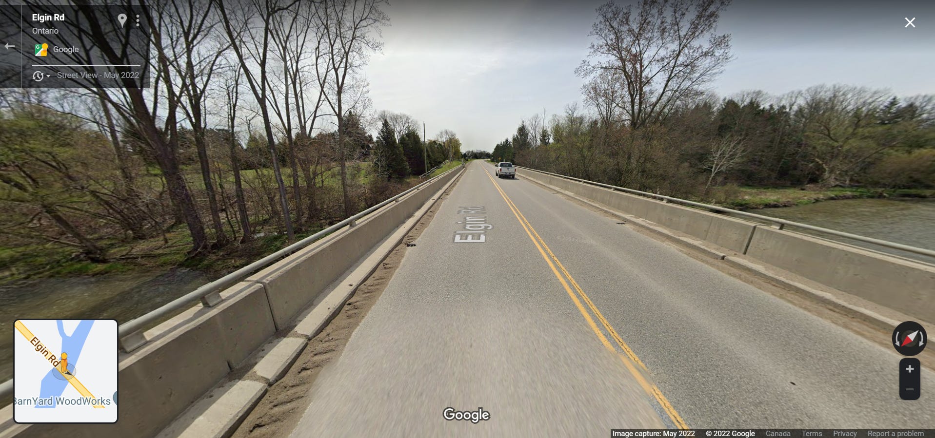
Eventually, the river straightens out (or was straightened out) and flows through the towns, or at least past the towns that were built on its banks. One section took me through a Catholic cemetery, another through a subdivision with streets like Iroquois Crescent and Arrow Place. The road follows the train tracks, which follow the river, the three routes running side-by-side-by-side like a museum of transportation.
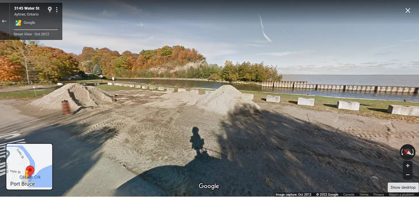
This is the end of the river section “where a due south course will lead to the mouth of Catfish Creek.” Again, the roads don’t quite line up here, none of them running exactly south, but I approximated. Imperial Road 73 brings you down through Mossley, Harriestville, Lyons, Aylmer, Candyville and Copenhagen. Past the Ontario Police College and a large honey farm, to Port Bruce.
Along the way are several signs with images of quilts printed on them — part of Elgin County’s Settlement Stories Quilt Trail documenting old community halls and the former site of the weekly newspaper’s print shop. The quilt for Port Bruce states that “the first visitor of note to ever visit this little port was Sir William Johnson on August 24, 1761.”
At Catfish Creek, one of the few places mentioned in the treaty that retains the same name today, there are no markers for the treaty, just a plaque courtesy of the Port Bruce Millennium Garden Committee documenting the fact that in 1763, the Superintendent of Indian Affairs ordered his men to fire three volleys as a royal salute upon learning of “THE SURRENDER OF BELLE ISLE TO HIS BRITANNIC MAJESTY ON JUNE 7, THE DEFEAT OF THE CHEROKEES JULY 10 AND THE REDUCTION OF PONDICHERRY IN THE EAST INDIES.”
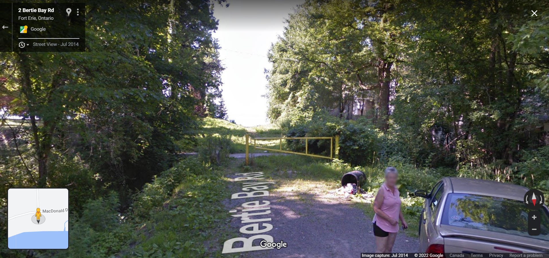
The next section is slow, 40km/h most of the way, one lane. At first, the farms that back onto the shoreline block any view of the water, except in the port towns. Further on though, the road runs right along the edge of the lake, past the summer homes that Erie has been encroaching on, slowly shrinking the size of the tract. The section ends somewhere near Bertie Bay, just outside Fort Erie at “the lands heretofore purchased from the said nation of Messissague Indians.”
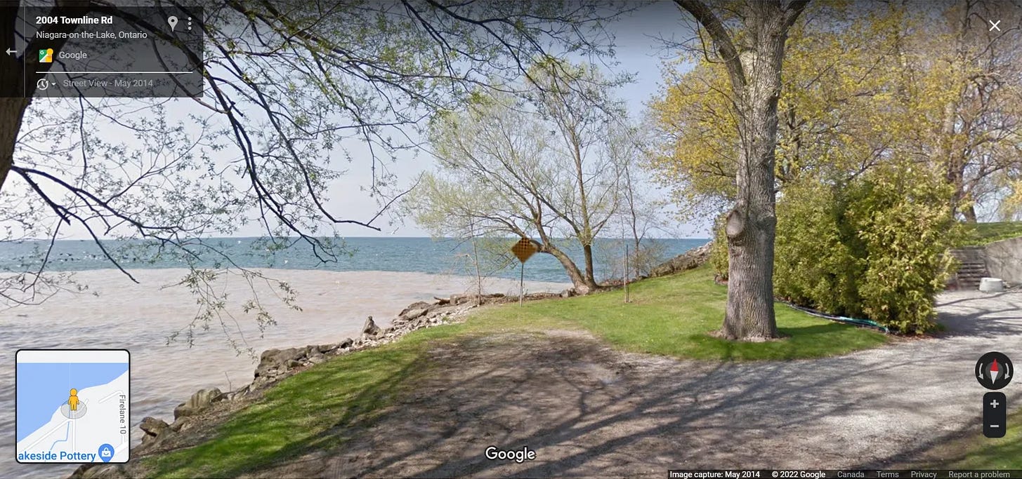
The final stop is just outside Niagara on the Lake, four miles west of the Niagara River, at the end of one of any number of firelanes that lead out to lakefront properties from the main road. From here, the boundary runs back along the shore of Lake Ontario and connects up with my starting place at Indian Point.
I have lived in this region my whole life and have driven many of these roads many times before. I drove through towns that relatives live in or have lived in, towns I've worked in or gone camping in. Seeing it with the treaty at the forefront of my mind gave me a new sense of how densely populated this area is, how intensively the land has been farmed and built upon, how trying to walk this boundary would likely bring conflict with landowners. Even within the privacy of my car, staying on public roads, I got many strange looks as I stopped to take photos of seemingly nothing.3
In Paul Carter’s excellent book on spatial history The Road to Botany Bay, he describes his project of reimaging New Zealand as being concerned with “footprints, trails of dust and foaming wakes.” The closest I came to finding any physical markers of the treaty boundary on my drive were the black and yellow checkerboards marking the end of a road. Certainly, there are thousands of other signs like these all over Southern Ontario but finding them in this context felt like a trace, a sign that something begins/ends here.
I’ll close off with this link to a Google Map I created of the treaty boundary. It is a bit rough, but helped me get a better sense of the tract, being able to zoom in and scroll around. With all of this, I’ve been trying to think a new shape, to see an old one — maybe this will help you do the same.
Certainly not an ideal mode of transportation. Maybe one day I’ll walk (or cycle) it.
I’ve since learned I was starting in the wrong spot. The site of the “creek” the treaty mentions was about a kilometre away on Lakeshore Road, just north of the Burlington Bay Canal — a now-buried natural outlet from the Hamilton Harbour (Washquarter) to Lake Ontario.
The poet Heather Christle once tweeted that she planned to make t-shirts for her writing workshop that said “I’m doing this for poetry.”
make work book shirts
Love this. I’m curious how this treaty interacted with the Haldimand Treaty of 1784. I know a sizeable portion of the Haldimand Tract along the Grand River was sold off/stolen during the next 10 or so years.