

Location Papers

The original crown surveyors, along with carrying out land surveys, were also tasked with documenting their work extensively in field notes, journals and logbooks. Much of this documentation has survived and is available through various archives on microfilm. Though Augustus Jones surveyed the entirety of the Between the Lakes Treaty boundary at one point or another, his 1792 survey of the Jones Baseline section is the best documented, so through the fall, I spent several days in McMaster’s Map Library reading his notes from this trip.
Beginning on Sunday, September 16th and covering up until Wednesday, October 17th, the notes document the party’s fifty-mile journey from the shore of Burlington Bay to present-day Arthur, ON. Along the way, he details the many creeks and cedar swamps, the varying soil qualities, as well as evidence of a hurricane and a forest fire. As the group progresses, the tree canopy shifts from oak, hickory and maple, to pine, tamarack and hemlock, basswood and ironwood later on.1 The level of detail, mile-by-mile, chain-by-chain, link-by-link, makes Jones’s notes a unique document of the ecology of the area before the brunt of European settlement.

To this day, the Jones Baseline still shapes the western shore of Lake Ontario as it forms much of the border between Hamilton and Burlington, as well as between Flamborough and Milton. Before the amalgamation of Wellington County in 1999, the upper section also formed the western borders of Eramosa and West Garafraxa Townships.
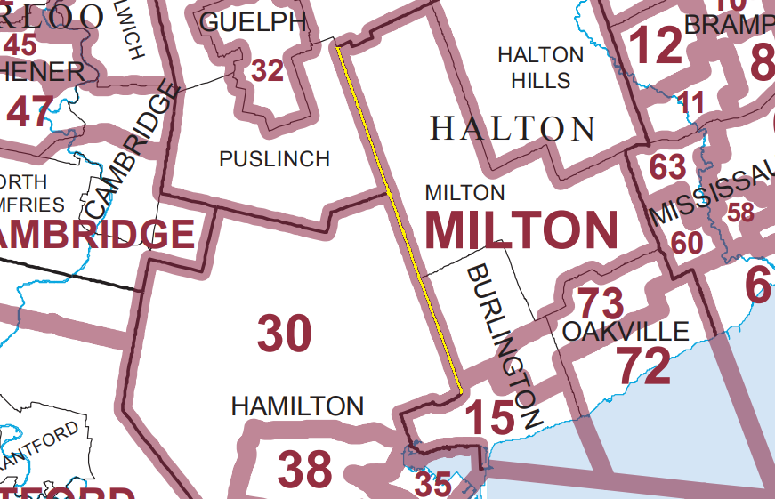
As I mentioned in the last newsletter, many of the treaties in Ontario use relative boundaries, so not only is the Baseline the northeastern border of the Between the Lakes Treaty, but it’s also the western boundary for the Brant Tract of 1795 (Burlington), The Head of the Lake “Purchase” of 1806 (Milton, Oakville, Mississauga) and the Ajetance “Purchase” of 1818 (Brampton, Northern Peel), as well as the northern boundary of the Haldimand Tract.

The Baseline was the first piece I covered in my drive around the treaty boundary. Unlike other portions of the boundary, which require maintaining a somewhat arbitrary compass bearing on roads that don’t match up, or attempting to follow the flow of a river, there is a corresponding road for much of the Baseline portion. Over the course of the drive, the road changes names many times from Kerns Road to Millburough Townline, Darkwood Road to Nassawageya-Puslinch Townline, Midway Line to Scotland Street to Gartshore Street, but it maintains the same bearing until its end.

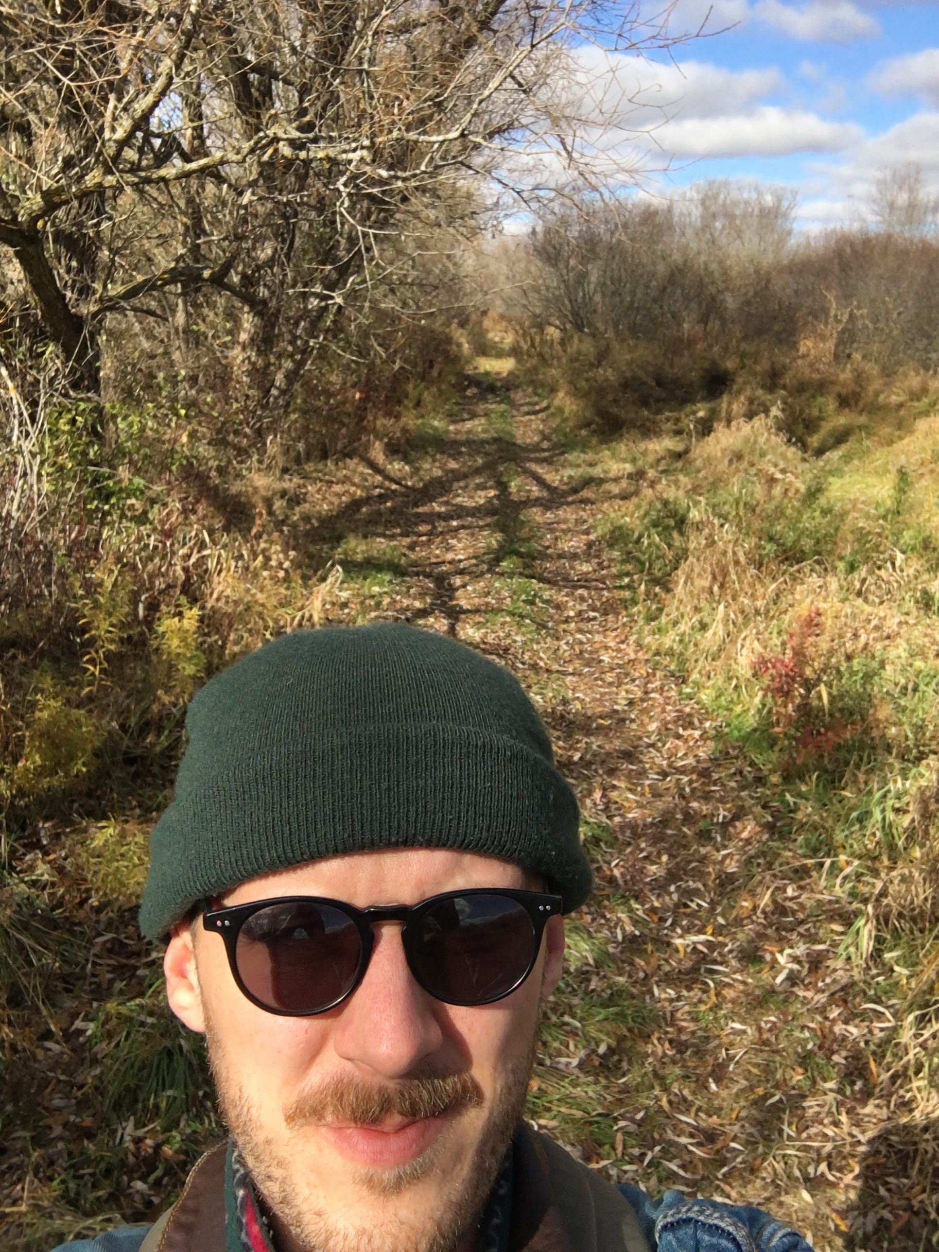
As I mentioned in my previous post, the northeastern boundary of the treaty begins in Burlington’s Indian Point neighbourhood.2 This is by far the most difficult section to track because of the winding suburban streets. These neighbourhoods, at least the side streets, were not planned on a grid and so at no point, from Lake Ontario up to the seven lanes of the 403, is there a road that follows Jones’s original survey line.
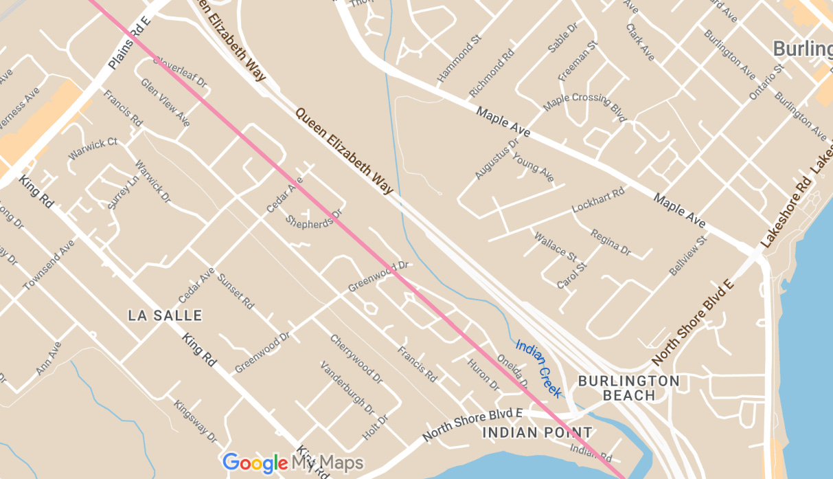
Not an auspicious start for my project, but I approximated past the gas stations, IKEA’s acreage, and the Hydro One power station. Through Bayview Park, up the escarpment on a road marked Local Traffic Only that ends at a concrete barrier marked Construction Traffic Only. Forced to take the first of many workarounds, I headed back down through the park to the North Service Road and up and around the closure.
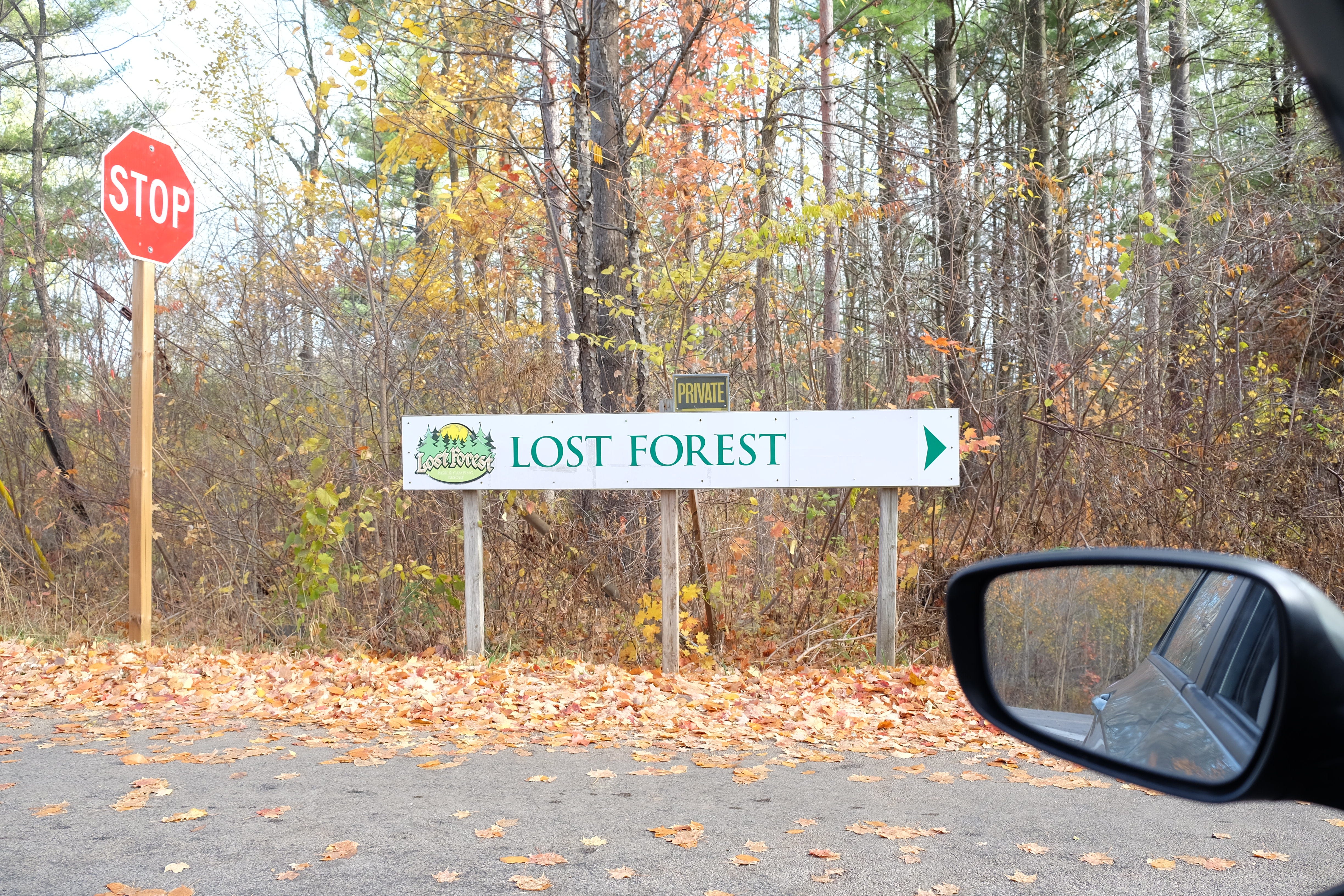
On the far side of the job site, the Lost Forest Campground, bucketed saplings in the production yard at Connon Nurseries, purple and orange ghosts hung from the cedar hedges, decorative squash and firewood for sale at the self-serve roadside stands. Up here, every gravel track has a sign attached, but each time a creek interrupts the line, there’s still no name visible, on the banks or in Google Maps.
Into the horse country — stables on the lot corners, lawn signs declaring I ♡ My Invisible Fence. I’ve got the laptop on the passenger seat for the aerial view as my phone calls out the turns, gently but persistently trying to push me back to Highway 6 which runs parallel to much of my route and is maintained year-round.
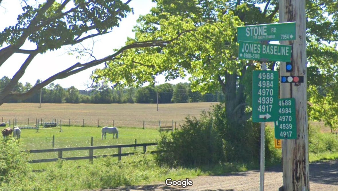
From here, the metonym disappears for a while and the road’s name becomes Jones Baseline. I cross the Conestogo River and the Grand. Into Fergus, and the road has another new name as it continues past Centre Wellington District High, light industry mining solutions.
On the far side of town, the road appears to end as Gartshore Street takes a hard right and becomes Sideroad 10 (closed Dec-Mar), but just past the concrete barriers and cattails at the turn, the line continues as a muddy ATV trail. I park the car on the corner and walk, through a corridor of trees at first, before it opens up into fields, the road still running as the dividing line between plots. I follow on foot until I see one too many hunting blinds and turn back for the highway.
I drive Highway 6 for a few kilometres, connect back up where the signs for the Baseline appear again, just before Arthur. The welcome sign for the town — the hub of the wheel of five treaty areas — proclaims it Canada’s Most Patriotic Village. Crossing over Brandy Creek and onto the main street, the first thing I see is a mural on the near side of an accountant’s office: a team of oxen and a farm deed inset on a Union Jack.
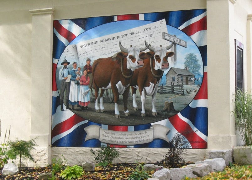
“The location of this mural is symbolic,” the description reads, “as this office building is the former County Registry Office…The mural itself depicts an early settler departing from the Registry Office with family and his yoke of oxen. The settler has in his hands his ‘location papers’ which entitles him to a free 50 acre plot of land in Arthur Township.”
The memory of this town is post-survey, the visual history beginning with Jones emerging out of an unformed void. Though the treaty is undepicted on any of the walls or plaques, it is still shaping this region, whether we realize it or not, the traces are just harder to find.
Here’s my transcription of Jones’s field notes for the true nerds.
I’ve since learned I was starting in the wrong spot. The corner I was looking for is actually about a kilometre away on Lakeshore Road, just north of the Burlington Bay Canal — the site of a now-buried natural outlet from the Hamilton Harbour to Lake Ontario.
So interesting. My birth certificate lists West Garafraxa as my place of birth — I never knew it was an extinct township. Very familiar with the stretch of Jones Baseline between Fergus and Guelph. Great piece, Ben!